基本情報
出展製品・サービス
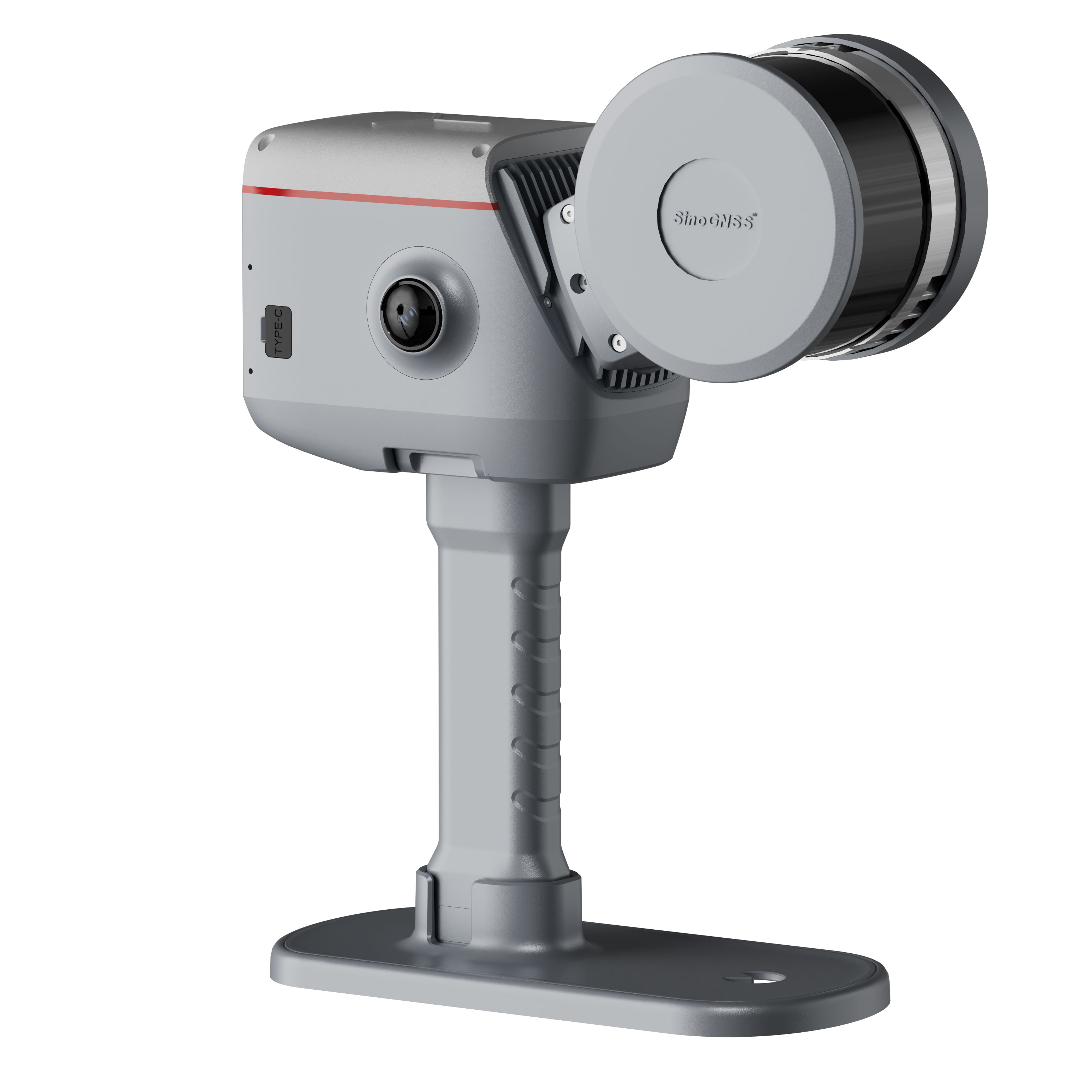
3Dレーザースキャナー LS600
3D Laser Scanner LS600
【測量調査・土木建設向け】ハンドヘルド型レーザースキャナー
LiDAR SLAM・Visual SLAM・GNSS・IMUの融合!
取得点群・高解像度の写真データ・解析後の結果がユーザーに好評。
点ではなく面として測量を行い、後処理ソフトウェアで平面図を作成することで、
従来業務を大幅に効率化します。
【For Surveying and Civil Engineering】Handheld Laser Scanner
Fusion of LiDAR SLAM, Visual SLAM, GNSS, and IMU!
Users highly praise the clarity of acquired point clouds and photos, as well as post-processing results.
Moving forward, surveying will be conducted as surfaces rather than points. Creating floor plans with post-processing software will significantly streamline conventional workflows.
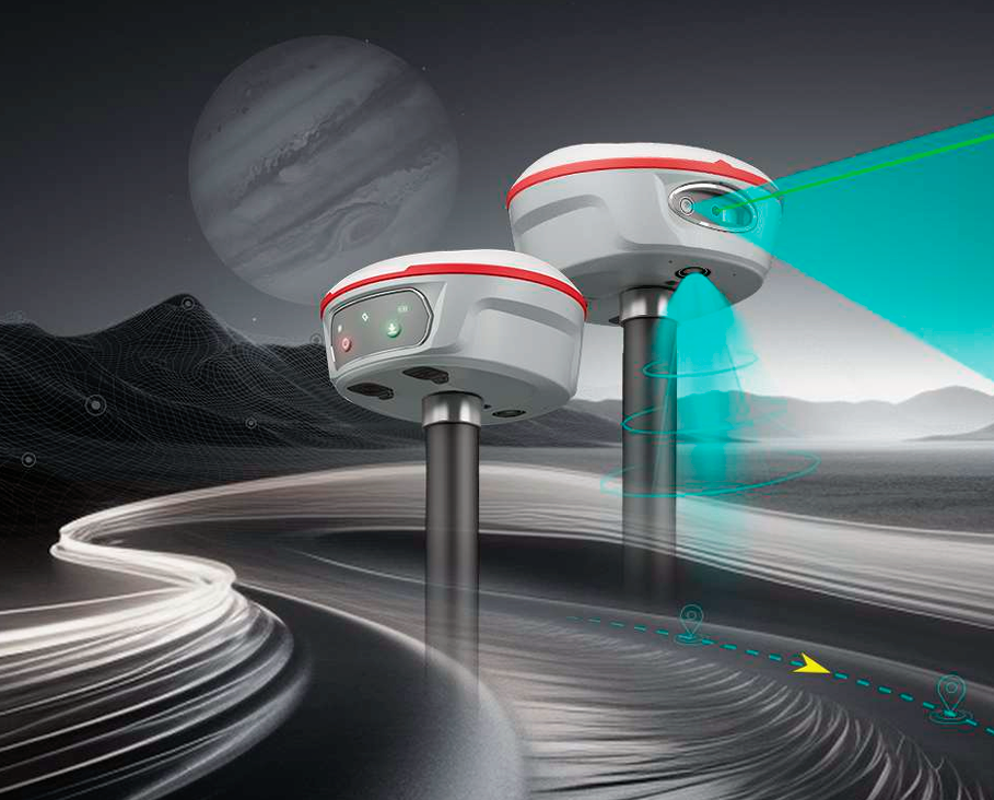
ビジュアルレーザーRTK GNSS受信機 ジュピター
Jupiter Laser Visual GNSS Receiver
【測量調査・土木建設向け】ネットワークRTKに特化したGNSS受信機
ツインカメラ+レーザー+IMU搭載のハイエンド受信機
様々な条件で従来の方法では測量できなかった場所をレーザーRTK計測可能に。
特にAR機能を使用したAR杭打ちは作業を劇的に効率化!防塵防水IP67
【For Surveying and Civil Engineering】
GNSS Receiver Specialized for Network RTK
High-End Receiver with Camera + Laser + IMU
Now survey locations previously inaccessible with conventional methods under various conditions!
Dustproof and Waterproof IP67
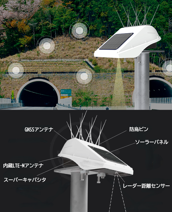
モニタリング用GNSS受信機 ロケーターワン
Wireless Mornitoring Locator One
【インフラの維持管理向け】モニタリング用GNSS受信機による精密変位計測。
NETIS登録。高精度・ワイヤレス・ソーラーパネル搭載・レーダー搭載・
通信チップ内蔵で中継器を介さずクラウドで24hデータを監視可能。
法面変位・地表面沈下・橋梁変位・矢板倒れ・水位などをシンプルな装備でモニタリングをコストダウン!
【For Infrastructure Maintenance】
Precision displacement measurement using monitoring GNSS receivers.
NETIS registered. High precision, wireless, solar panel-equipped, radar-equipped, with built-in communication chip enabling 24/7 cloud data monitoring without repeaters.
Monitor slopes, ground subsidence, bridges, sheet piles, water levels, and more with simple equipment to reduce monitoring costs!