基本情報
出展製品・サービス
DJI産業用ドローンプラットフォームと高性能ペイロードの統合ソリューション
DJI Integrated Drone Platforms and Advanced Payloads Transforming Construction and Surveying Operations
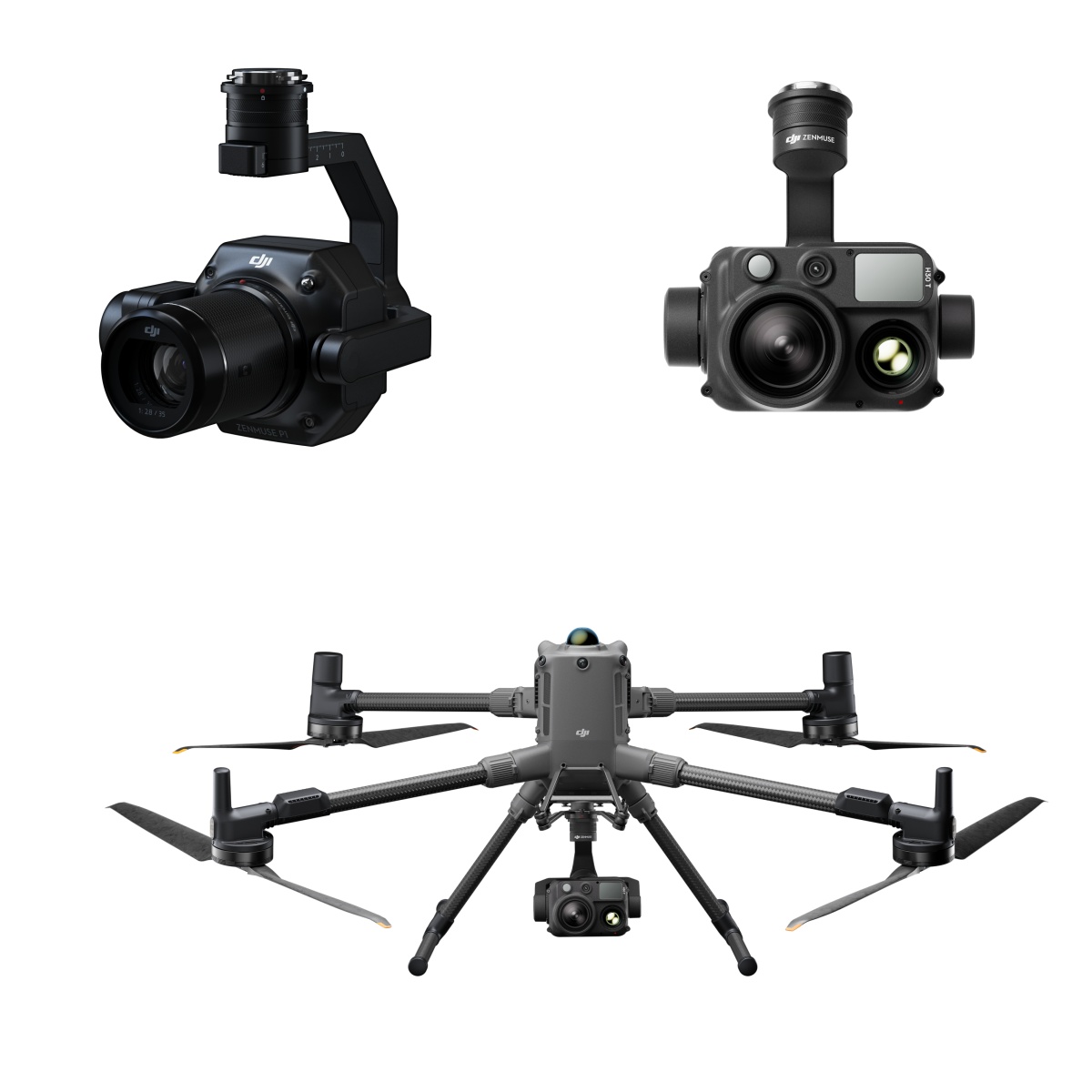
DJI Matrice 4 Series(DJI Matrice 4T / DJI Matrice 4E)、DJI Matrice 400、DJI Matrice 4D / DJI Matrice 4TDなどの先進的な産業用ドローンプラットフォームと、 Zenmuse L3、 Zenmuse H30 Series、Zenmuse P1などの高性能ペイロードを組み合わせることで、建設・測量分野における多様な業務ニーズに対応します。高精度測量、3Dマッピング、インフラ点検、現場巡視などの作業を効率的かつ安全に実施でき、広範囲の現場でも短時間で高品質なデータ取得が可能です。さらに、用途に応じて機体とペイロードを柔軟に組み合わせることで、測量から点検、施工管理まで一貫したワークフローを構築し、作業効率の向上、省人化、安全性向上に貢献します。ドローンとセンサーの統合ソリューションにより、建設現場のデジタル化とDX推進を力強く支援します。
Advanced industrial drone platforms including the DJI Matrice 4 Series (Matrice 4T / Matrice 4E), Matrice 400, and Matrice 4D / 4TD, combined with high-performance payloads such as the Zenmuse L3, Zenmuse H30 Series, deliver a versatile aerial solution for construction and surveying professionals. This integrated platform-and-payload ecosystem supports a wide range of applications including high-precision surveying, 3D mapping, infrastructure inspection, and site patrols. By flexibly pairing aircraft with specialized sensors, users can efficiently capture high-quality data across large job sites while improving operational safety and productivity. The combined system enables a seamless workflow from surveying to inspection and construction management, helping accelerate digital transformation and smarter site operations.
DJI Dock 3
DJI Dock 3
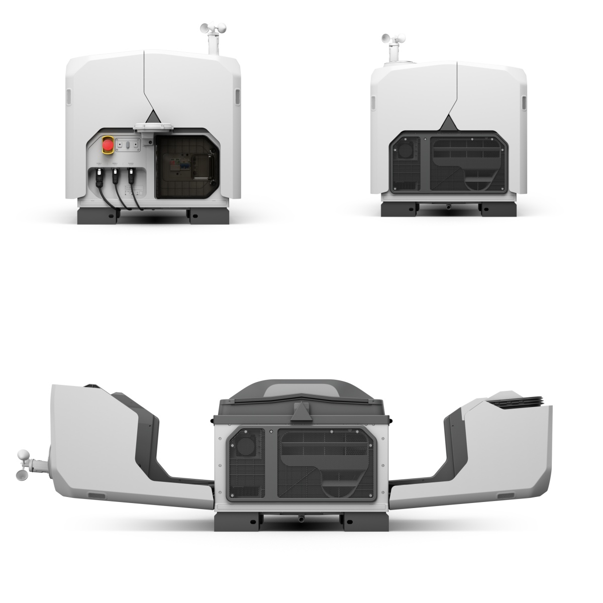
DJI Dock 3は、建設・測量分野におけるドローンの自動運用を実現する次世代ドローンポートです。遠隔からの操作により、ドローンの自動離着陸、充電、定期巡回、データ取得までを一体的に管理でき、広い建設現場やインフラ施設における効率的な運用を可能にします。全天候型設計により、屋外の過酷な環境下でも安定した稼働を実現し、現場巡視、施工進捗の確認、測量データの取得、設備点検など幅広い用途に対応します。さらに、定期的な自動飛行とリアルタイムデータ取得により、現場状況の可視化と迅速な意思決定を支援し、作業の省人化・安全性向上・業務効率化に貢献します。建設DXの推進を支えるソリューションとして、スマートで持続可能な現場管理を実現します。
The DJI Dock 3 is a next-generation drone docking station designed to enable automated drone operations for the construction and surveying industries. Through remote management, it integrates automatic takeoff and landing, charging, scheduled patrol flights, and data collection, enabling efficient operations across large construction sites and infrastructure facilities. Its all-weather design ensures stable performance in challenging outdoor environments, supporting a wide range of tasks such as site patrols, construction progress monitoring, surveying data collection, and facility inspections. With scheduled autonomous flights and real-time data acquisition, it helps visualize site conditions and supports faster decision-making, while reducing manpower requirements and improving safety and operational efficiency. As a solution supporting construction DX, it enables smarter and more sustainable site management.
DJI Terra/Flight Hub 2-ドローンデータを活用する統合ソフトウェアプラットフォーム
DJI Terra/FlightHub 2-Integrated Software Platform for Drone Operations and Data Intelligence
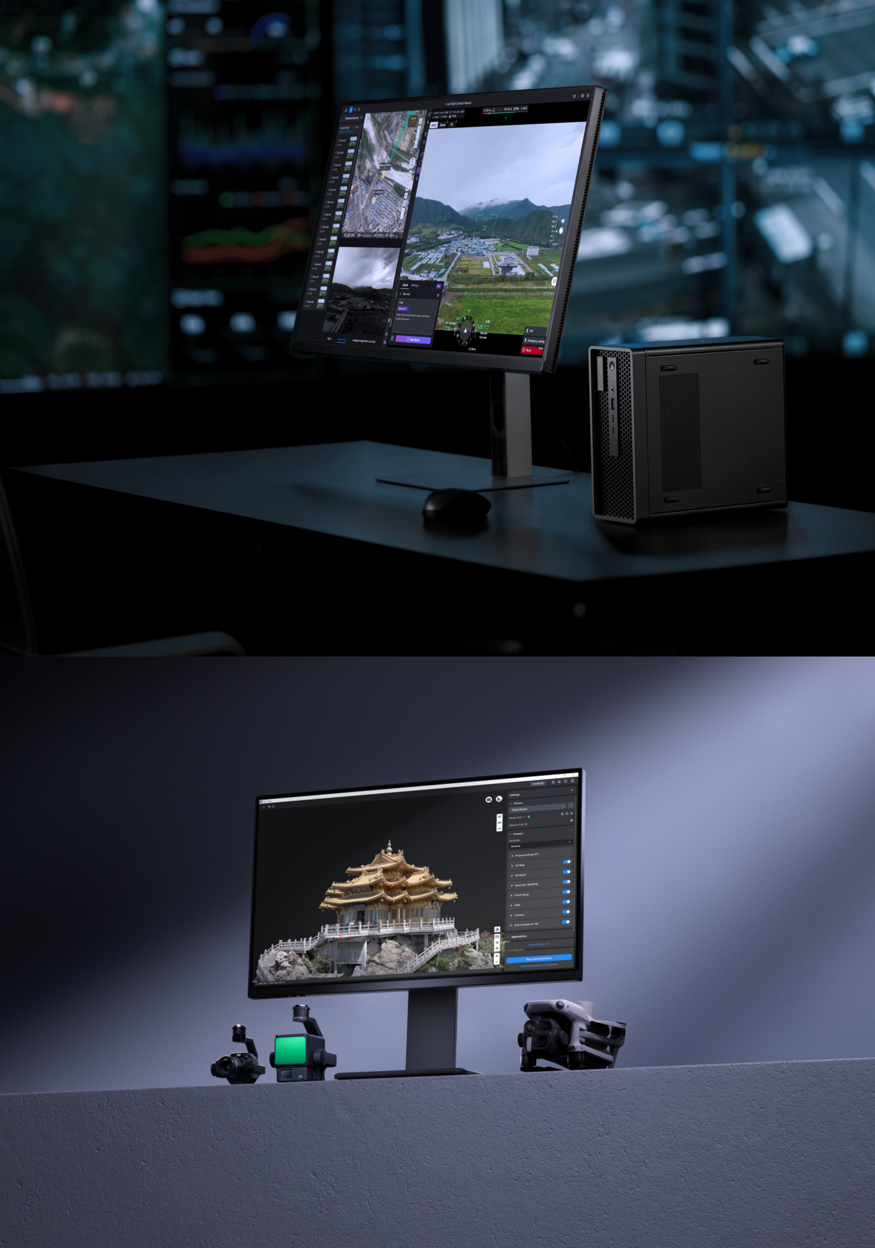
DJI TerraとDJI FlightHub 2は、産業用ドローンの運用からデータ活用までを一体化する統合ソフトウェアソリューションです。DJI Terraは、空撮データから高精度な2Dマップや3Dモデル、点群データを構築できる解析ソフトウェアで、測量や地形把握、施工管理などに活用できます。一方、FlightHub 2はクラウドベースのドローン運用管理プラットフォームとして、複数機体の遠隔管理、ミッション計画、リアルタイム映像共有、データ管理を可能にし、現場とオフィス間の連携を強化します。両ソフトウェアを組み合わせることで、現場で取得したデータを迅速に可視化・共有し、測量、点検、施工管理などの業務プロセスを効率化。建設・測量分野におけるデータドリブンな意思決定を支援し、現場のデジタル化とDX推進に貢献します。
DJI Terra and DJI FlightHub 2 together form an integrated software solution that connects drone operations with data analysis. DJI Terra enables users to generate high-precision 2D maps, 3D models, and point cloud data from aerial imagery, supporting applications such as surveying, terrain analysis, and construction progress management. DJI FlightHub 2 is a cloud-based drone fleet management platform that enables remote mission planning, multi-drone management, real-time video sharing, and centralized data collaboration between field teams and offices. By combining these two platforms, organizations can quickly process and visualize drone data, streamline workflows for surveying, inspection, and construction management, and support data-driven decision-making for smarter and more efficient site operations.