基本情報
革新的なハードウェアと要望に応じて開発したソフトウェアを組み合わせたソリューションを提供します。
By developing the latest hardware and software that suits our customers, we provide solutions that no other company can offer.
出展製品・サービス
X200GOマルチプラットフォーム LiDAR SLAM
X200GO SLAM Laser Scanner
X200GOは、ハンディ、ドローン、車載、すべてのアプリケーションに対応可能な1台で複数の役割を担うことができるコストパフォーマンスの高い革新的なLiDAR SLAMです。
300m計測可能なレーザーを搭載し、レーザー部分が回転することによって、あらゆる環境においても計測可能なシステムとなっております。
2つの高解像度広角カメラおよびRTKモジュールを搭載していることにより、リアルタイムにカラー点群生成と座標付けを可能にし、現場において三次元計測結果を即時確認することができます。
カメラで取得した高解像度画像を三次元データと重ね合わせることができ、現場の状況を画像でも確認することが可能です。さらにその画像上において、計測することもできます。
SLAMモードのみではなく、X-WHIZZモード機能があり、地上型レーザーと同等の計測も可能な最新式のLiDAR SLAMです。
点取得数64万点/秒であり、これまでSLAMの点密度においても最上位クラスとなります。
点群と写真の重畳機能も搭載、さらに3DGS(ガウシアン・スプラッティング)にも対応し、最新のソリューションを提供します。
The X200GO is the latest generation system based on the SLAM technology, capable of covering any customer need.
The range of up to 300 meters and a rotating head that maximizes the coverage of the laser beam make it versatile for any environment. Equipped with 2 cameras and RTK receiver for real-time point cloud coloring and orientation.
The two cameras provide navigable and measurable panoramic cameras superimposed on the 3D model. The system allows for the survey of static scans in X-Whizz mode, automatically aligned to the SLAM survey.
Backpack, shoulders hook, car mount and holder for DJI M350 can complete the system.
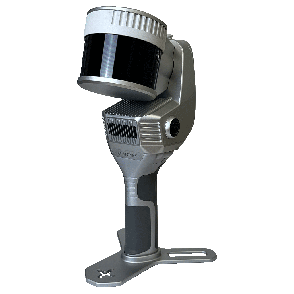
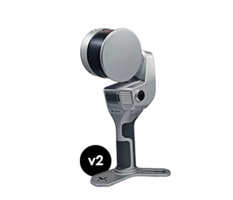
STONEX X120GO v2 新製品 SLAMハンドヘルドレーザースキャナー
X120GO v2 SLAM Laser Scanner
X120GO v2は、これまでのX120GO(初代モデル)から刷新した最新のハンドヘルドレーザースキャナーです。
初代モデルのX120GOは、日本国内においても数多く導入いただいた実績があり、その後継機種がX120GO v2となります。
初代モデルでは点取得数が32万点/秒のみでしたが、X120GO v2では64万点/秒の高密度モデルが追加されました。
STONEX社のSLAM製品は、用途に応じて機種を選定できるだけのラインナップがあり、最適なSLAM製品をご提案します。
The X120GO is the latest generation system based on the SLAM technology, capable of covering any customer need. The range of up to 120 meters and a rotating head that maximizes the coverage of the laser beam make it versatile for any environment.
Equipped with 2 cameras and GNSS receiver for real-time point cloud coloring and orientation. The two cameras provide navigable and measurable panoramic cameras superimposed on the 3D model.
The system allows for the survey of static scans in X-Whizz mode, automatically aligned to the SLAM survey.
Backpack, shoulders hook, car mount and UAV mount for DJI M350 can complete the system.
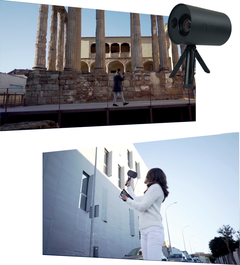
XVSビジュアルSLAM(次世代型写真測量システム)
XVS vSLAM 3D Scanner
XVSはこれまでに見たことのない次世代のハンディ写真測量システムです。
特に構造物の計測に適しており、点群データだけではなく、メッシュデータも自動生成することで、3次元データでありながら、写真同等のデータを得ることができます。
本システムでは、高解像度画像、慣性システムおよび複合したアルゴリズムに基づいた技術が用いられています。XVSでシナリオを記録すると、写真測量技術によって3Dモデルが生成されます。歩きながら動きのあるシーンを記録すると、リアルタイムインターフェイスがデータ記録方法をガイドし、推奨の移動速度を提示します。そして必要に応じて計測エリアへ戻って十分に画像がオーバーラップするようにします。
Visual SLAMシステムのおかげで、リアルタイムにタブレット上に軌跡が表示されます。慣性計測装置(IMU)センサーは、アルゴリズムが連続した画像ブロックを生成するのに役立ちます。
オフィスに戻り3Dモデルを生成するための手順は、STONEX社のクラウドへデータをアップするだけで完全に自動化されます。
The system uses a technology based on the integration of high-resolution images, inertial systems and a complex algorithm: capturing a scenario with XVS, 3D model will be generated through photogrammetric techniques.
Walking and capturing the scene in motion, a real-time interface will guide you in the data collection, suggesting the speed of your movement and if necessary returning to an area to have enough image overlapping.
Thanks to Visual SLAM system (Simultaneous localization and mapping), your trajectory is displayed in real-time on a tablet. The Inertial Measurement Unit (IMU) sensor helps the algorithm to generate a continuous image block. The best result will be obtained automatically. Back in the office, the procedure to generate the 3D model is fully automatic, through a desktop PC.
Data coming from XVS can be integrated with video from UAV drone or any camera for a complete reconstruction of the area.