基本情報
出展製品・サービス
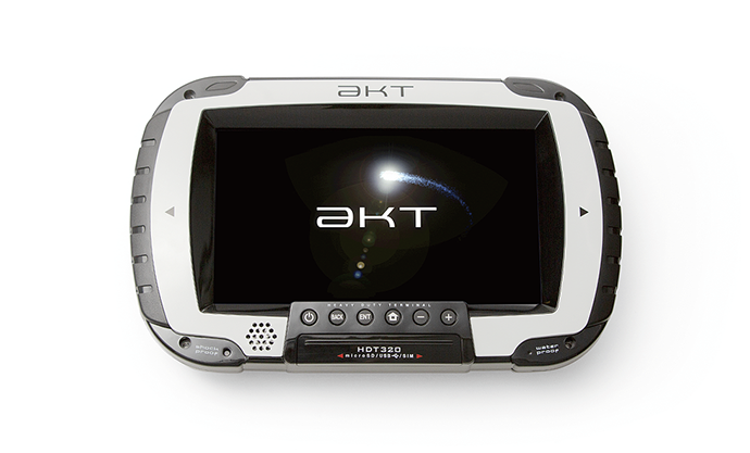
HDT320 2周波 RTK-GNSS受信タブレット端末
HDT320 Dual-Frequency RTK-GNSS Receiver Terminal
https://www.akasakatec.com/products/hardware/hdt320/
HDT320は、AndroidOSを搭載した堅牢型・多機能端末です。2周波RTK-GNSSを2基搭載、スマホ感覚の操作性、重機への接続を前提に作られた強固な筐体、信頼性の高い物理ポートインターフェイスが特徴。現場・ビジネスニーズに応じた多種多様なアプリケーションに対応できます。
【対応アプリケーション】
・SmartRoller クラウド型転圧管理システム
・SmartPile クラウド型地盤改良管理システム
・SmartScraper 路面切削厚計測システム
・SmartAgitator 地盤改良誘導システム
https://www.akasakatec.com/en/products/hardware/hdt320/
The HDT320 is a rugged, multi-functional android tablet with 2 built-in Dual-Frequency RTK-GNSS Receivers. With an easy to use smartphone-like interface, rugged enclosure and reliable physical ports, the HDT320 is built for many real-life worksite applications.
Application
・SmartRoller Cloud Compaction Management System
・SmartPile Ground Improvement Management System
・SmartScraper Road Excavation Measurement System
・SmartAgitator Ground Improvement Guidance System
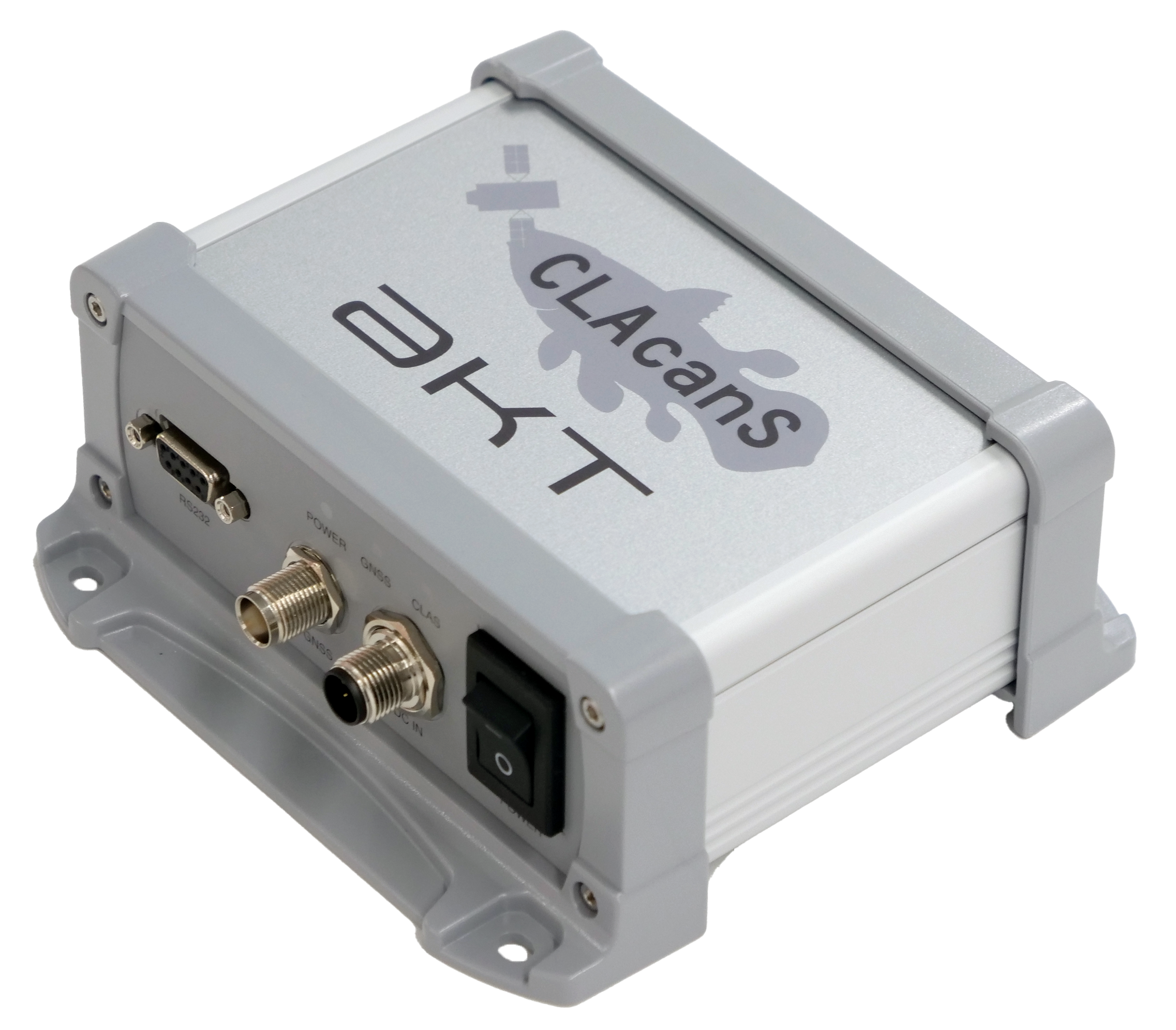
CLAcanS CLAS対応 GNSS受信機
CLAcanS CLAS GNSS Receiver
https://www.akasakatec.com/products/hardware/clacans/
CLASに対応したGNSS受信機です。準天頂衛星(みちびき)から配信されるセンチメータ級測位補強サービス『CLAS』を受信し、簡単にセンチメータ級の位置精度を得ることができます。
CLAcanSの主な特徴
・CLASの補強情報を受信
・従来のDGNSSよりも高精度
・IP65準拠の防水防塵性能
・ジャミング、スプーフィングへのセキュリティ強化
・PCのUSBポートやモバイルバッテリーで動作可能(5V 駆動)
https://www.akasakatec.com/en/products/hardware/clacans/
CLAcanS is a GNSS Receiver that utilises CLAS signal provided by geo-stationary satellite (QZSS) to get cm-level accurate measurements even in remote areas of Japan.
CLAcanS Main Features
CLAS Positioning Augmentation Data Receiver
Higher Accuracy than Traditional DGNSS
IP65 Rated
Jamming and Spoofing Resistance
Power via USB or Battery (Power Rating 5V)
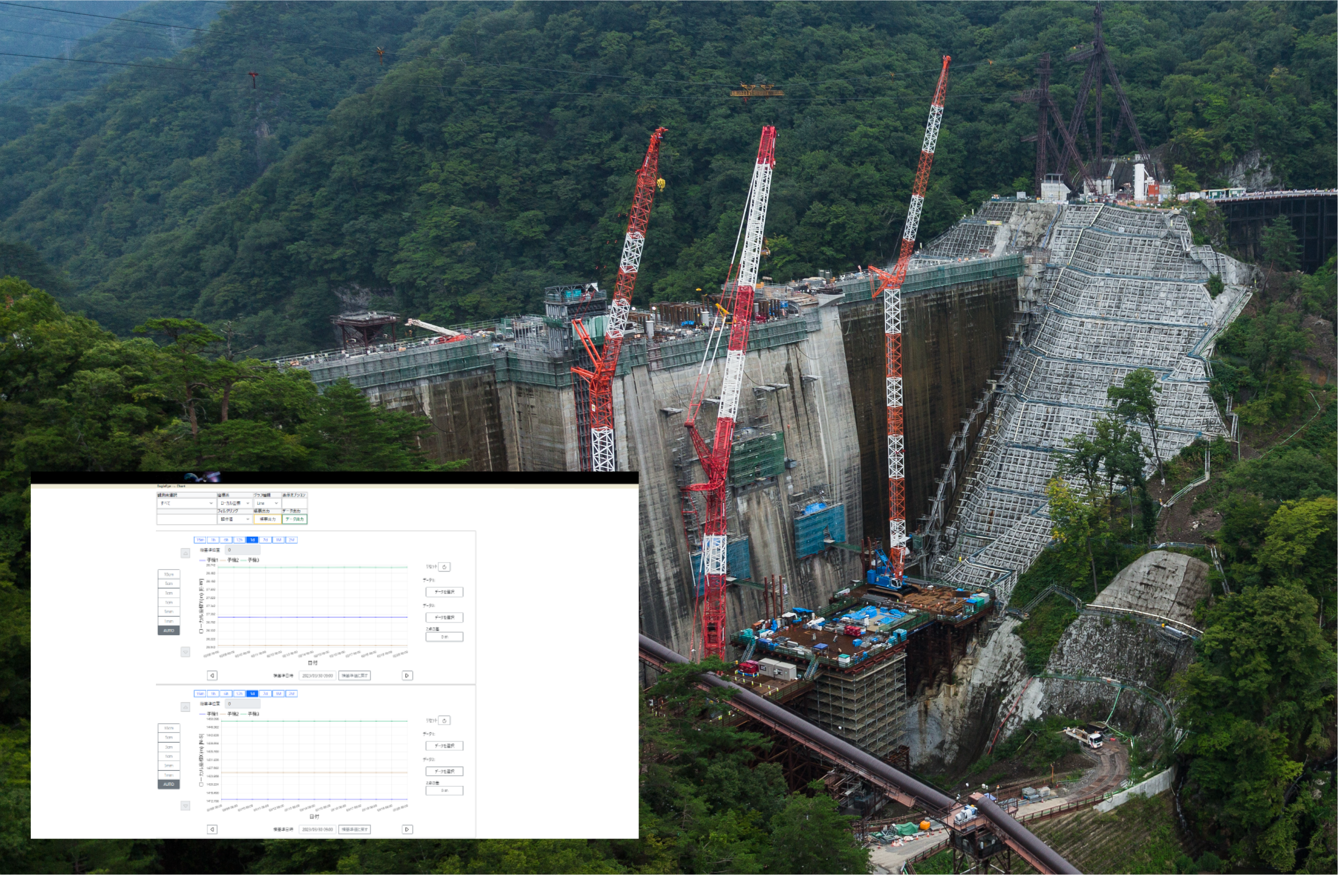
EagleEye クラウド型変位計測システム
EagleEye Slope Deformation Monitoring System
https://www.akasakatec.com/products/software/eagleeye/
EagleEye(イーグルアイ)は、GNSS受信機を用いた変位計測システムです。トンネル掘削時の地山の挙動や、道路やダムののり面、工事現場における山留めや土留めなどの変位を長期的に監視します。計画した観測点に単管などでGNSSを設置し、24時間365日常時ミリオーダーの計測を行い、長期的にデータ取得をすることで変位兆候をとらえます。
EagleEyeの主な特徴
・ミリオーダーの高精度測位
・24時間365日変位をモニタリング
・作業員の安全や業務の効率化を支援
・クラウドサーバで15分毎の解析、変位状況はブラウザで確認
https://www.akasakatec.com/en/products/software/eagleeye/
EagleEye is a mm-level accurate deformation monitoring system that utilises surmised data from single frequency GNSS static position data that was then analysed in 15 minutes intervals. EagleEye provides a reliable, all year round monitoring and warning system for terrain deformations in infrastructure projects such as railroads, dams, tunnels etc.
EagleEye Main Features
Millimetre-Level Accurate Positioning
All Year Round Constant Monitoring
Increase Safety and Increase Quality of Operation
Highly Accurate and Precise Positional Reading Every 15 Minutes