基本情報
出展製品・サービス
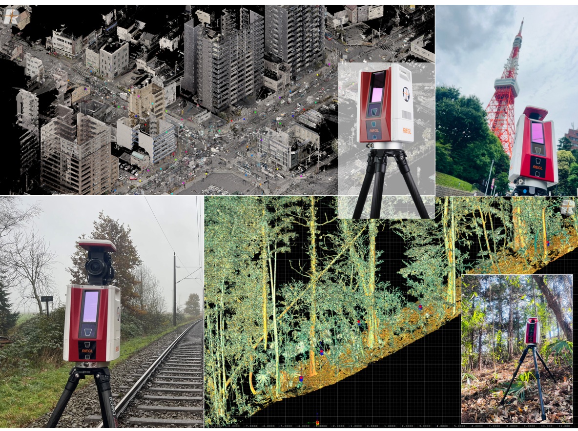
VZ-600i TLSハイエンドモデル
RIEGL VZ-600i
TLS(地上型3Dレーザースキャナー)ハイエンドモデル RIEGL VZ-600i
6mm解像度@10mをわずか30秒で計測、同時にRGB情報も取得。
計測されたデータは、スキャナー内部の高速処理によって自動合成されていきます。
類を見ない圧倒的なスピードで現場の効率化、生産性向上に大きく貢献しています。
このスピード、簡単さをぜひブースでご体験ください。
The RIEGL VZ-600i offers a broad range capability from 0.5 m up to 1000 m and is suitable for indoor and outdoor 3D mapping applications. 3D position accuracy of 3 mm, less than 30 sec scan time for high-resolution scans with 6 mm point spacing at 10 m, enabling more than 60 scan positions/hour with real-time registration, weight less than 6 kg, 2.2 MHZ PRR, three internal cameras & GNSS integrated, and also prepared for mobile mapping applications – these key features will speed up your workflow in indoor and outdoor applications like AEC (Architecture, Engineering, Construction), BIM (Building Information Modeling), as-built surveying, forensic and crash scene investigation, archeology & cultural heritage documentation, forestry, and many more.
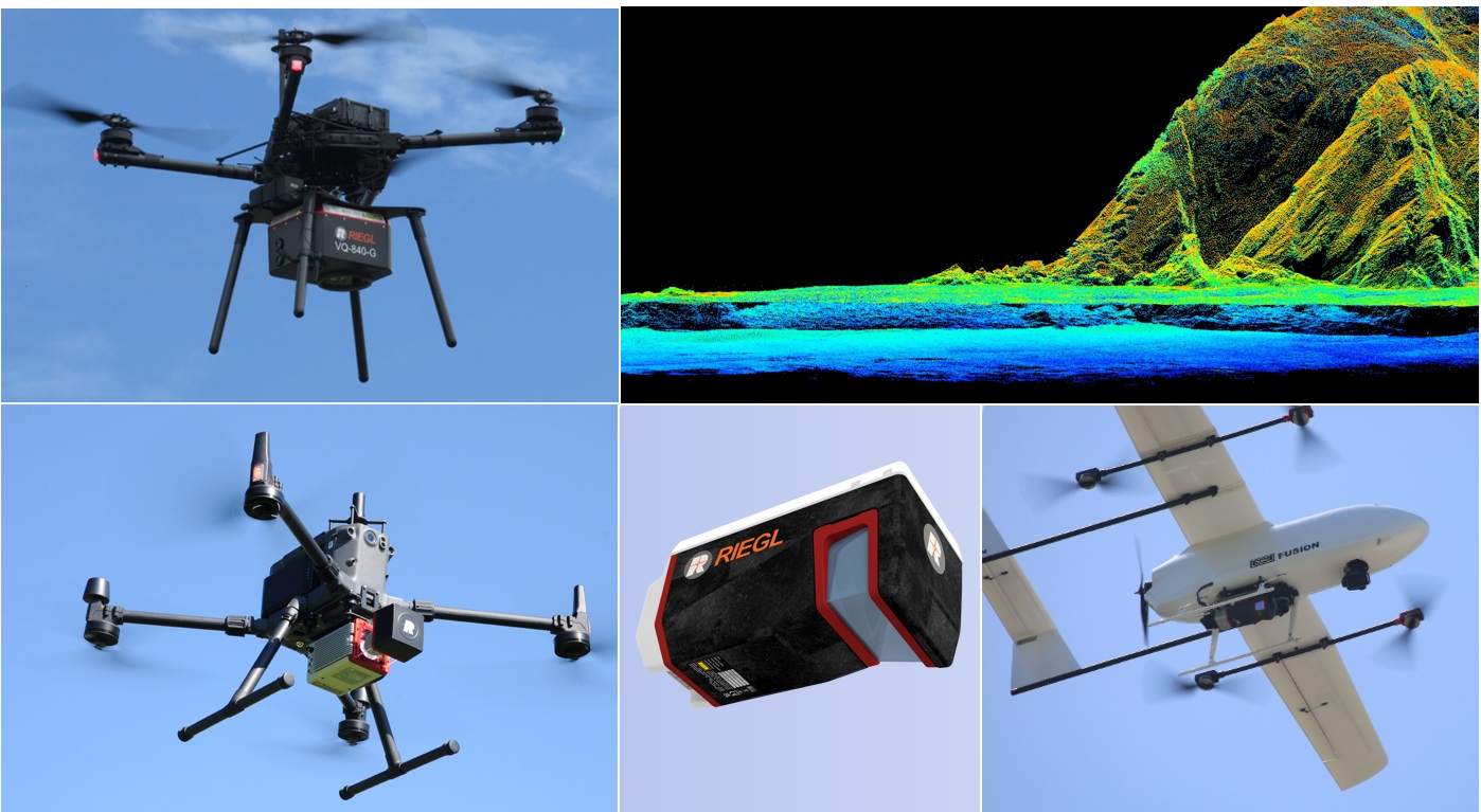
ハイエンドUAV LiDARシステム
UAV LiDAR systems
RIEGL UAV LiDARのラインナップは、全てサーベイグレード、測量業務に対応できる高品質の点群データを提供いたします。
エントリーモデルからハイグレードモデル、グリーンレーザー等、用途にあわせたLiDARを各種取り揃えております。
Utilizing high-end unmanned airborne platforms, provides the possibility to acquire data from dangerous and/or hard-to-reach areas, whilst offering a high cost to benefit ratio for numerous applications, e.g., agricultural and forestry, defense, wide area mapping, flood zone mapping, topography and mining. With a new line of ultimate survey-grade airborne scanners especially developed for UAV/UAS/RPAS-based applications RIEGL revolutionizes the commercial and civil market providing first-class technique for this new dynamic topic.
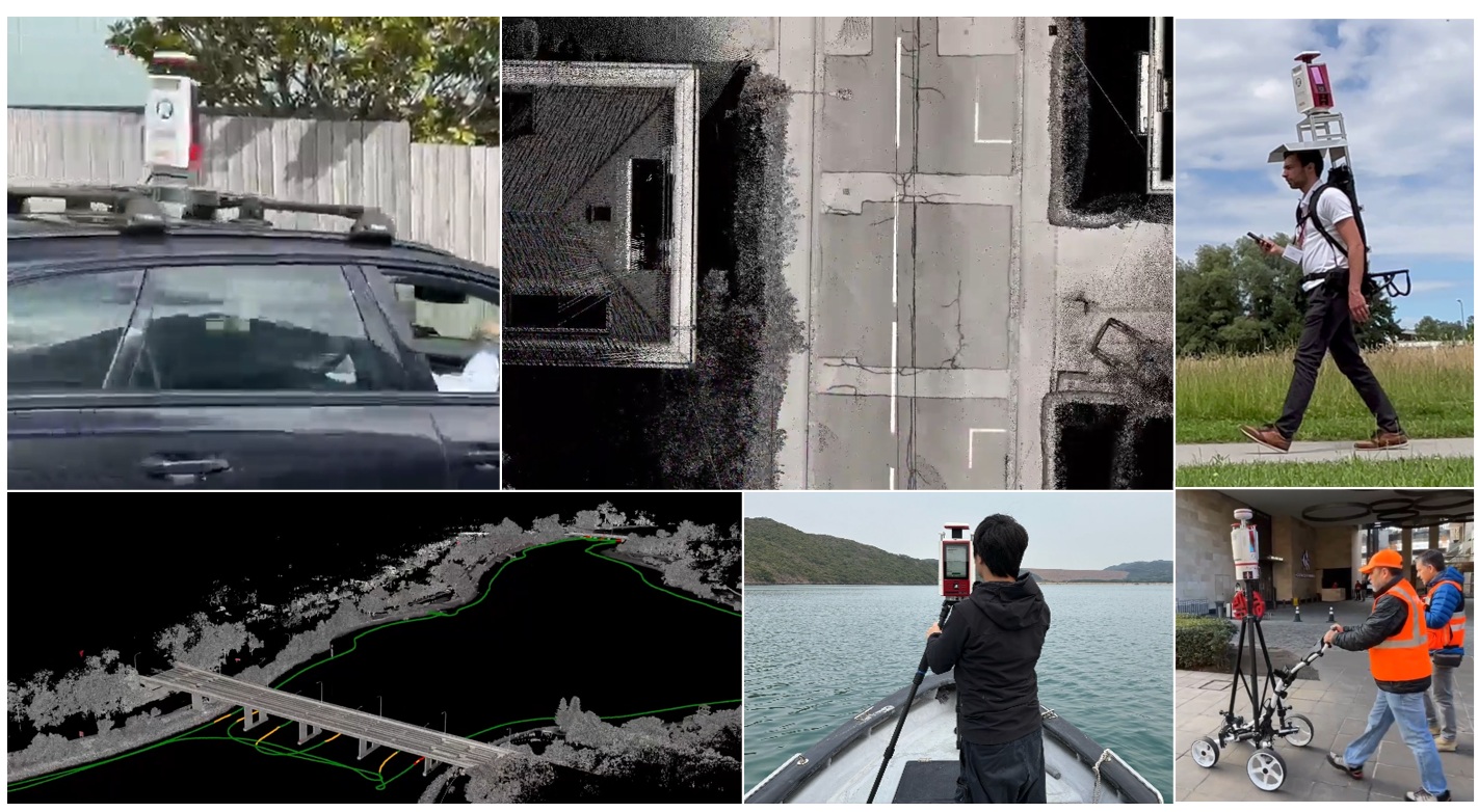
VZ-600i Kinematic App
TLS Kinematic App
TLSの概念を打ち破るアプリケーション!
RIEGL VZ-600iは、通常のスタティック計測から簡単に移動体(Kinematic)計測へ切り替えることが可能です。高価なIMUを必要とせず、ソフトウェア処理にて高精度な3次元データが生成されます。
MMSまでの要件を必要としない広範囲エリア計測には最適なアプリケーションです。
車、カート、ボート、バックパック等、幅広いプラットフォームで運用可能です。
RIEGL VZ-i series 3D terrestrial laser scanners can be switched right away from static to kinematic data acqui
sition without additional equipment.